

The group’s earth-observation line began in 2017 as the Wide Area Monitoring System (WAMS) project, a partnership with Vancouver-based 3vGeomatics (3vG) to track ground motion at city and region scale from satellite radar, supported by the Consortium of Aerospace Research in Canada (CARIC) and Mitacs.
By 2020, the machine-learning work built on that foundation earned a $500,000 NSERC award to launch Phase II. The aim was to turn research ideas into applied tools for predicting ground displacements: landslides, subsidence, and the slow failures that precede disasters. A three-year plan set out to preserve accuracy while using ever fewer satellite images.
The team on that phase included PhD students Subhayan Mukherjee and Alvin Sun, and master’s students Arjun Umashankar and Harini Hariharakrishnan, alongside students from the multimedia master’s program.
Today the work reports movement plus a 0–1 trust score at every point, across scenes of roughly 600 million pixels. It is deployed across roadways, railways, dams and mining.
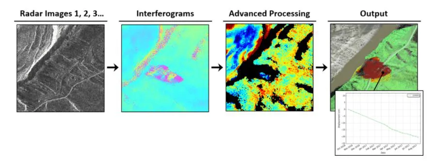
The pipeline behind the system: radar images become interferograms, then a per-pixel map of ground movement paired with a 0 to 1 trust score.
Cover: cumulative displacement, Vancouver International Airport — © 3vG.
Further reading: Using machine learning to help industry predict disasters before they happen (UofA Faculty of Science News, March 2020).