

Remote observation means gathering data about something without being on-site with it. The goal is always the same: acquire a signal, analyse it, and transmit the result, so that a decision can be made without a person standing at the scene. It complements ground operations rather than replacing them.
The discipline spans four vantage points.
Space
Satellites look down from orbit. Radar and optical sensors track ground displacement, vegetation health and water bodies across whole regions at once. The data ranges from a 1D radar signal to a 2D satellite map, covering ground that no survey crew could reach.
Air
Aircraft and drones fill the gap between orbit and ground. A drone over an open field can monitor cattle, survey crops or inspect infrastructure, usually as 2D video or imagery, at a resolution satellites cannot reach.
Land
On the ground the same idea drives robotics, Internet-of-Things sensors and assistive monitoring: a robotic arm guided by a camera, a greenhouse sensor watching for crop disease, an eldercare system tracking movement in a room. The sensor sits close, but the observer is still remote.
Sea
Marine sensing extends the reach across water, where fixed survey is hardest and remote data matters most.
One signal, many dimensions
Cutting across all four vantage points is the shape of the data itself: a 1D signal, a 2D image, a 3D point cloud, and beyond into K-dimensional feature spaces. What unifies them is method, not hardware. Whatever the platform, AI, signal processing and communication turn the remote signal into a decision.
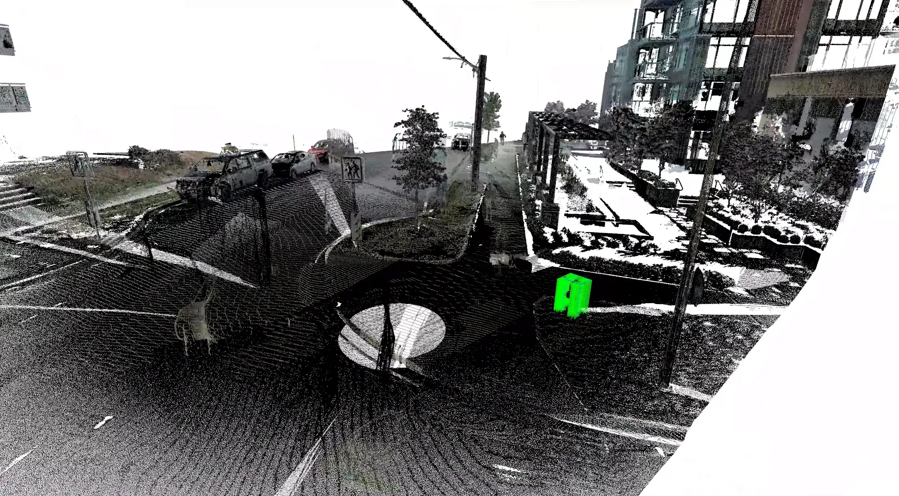
The high-dimensional end of that spectrum: LiDAR reconstructs a scene as millions of (x, y, z) points, the same signal-to-decision idea carried on the ground instead of in orbit. Courtesy McElhanney.
That is the organizing idea behind ROSS: one analytical discipline, any sensor, any platform. The rest of this series follows it from orbit down to the ground.